


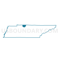
02-1 The Church at Grace Park Voting District, Robertson County, Tennessee
About
Outline

Summary
| Unique Area Identifier | 669433 |
| Name | 02-1 The Church at Grace Park Voting District |
| County | Robertson County |
| State | Tennessee |
| Area (square miles) | 17.29 |
| Land Area (square miles) | 17.29 |
| Water Area (square miles) | 0.00 |
| % of Land Area | 100.00 |
| % of Water Area | 0.00 |
| Latitude of the Internal Point | 36.47075840 |
| Longtitude of the Internal Point | -86.68790480 |
Maps


Graphs
Select a template below for downloading or customizing gragh for 02-1 The Church at Grace Park Voting District, Robertson County, Tennessee


Neighbors
Neighoring Voting District (by Name) Neighboring Voting District on the Map
- 01-1 East Robertson H.S. Voting District, Robertson County, TN
- 03-1 S. Haven Chrisitan Sch. Voting District, Robertson County, TN
- 03-2 Bethlehem Baptist Ch. Voting District, Robertson County, TN
- 04-1 Ridgetop Adventist Elem. Voting District, Robertson County, TN
- 08-3 Owens Chapel Fellow Hall Voting District, Robertson County, TN
- 12 Oakmont Voting District, Sumner County, TN
- 12 White House City Hall Voting District, Sumner County, TN
- 12 White House Middle School Voting District, Sumner County, TN
Top 10 Neighboring County Subdivision (by Population) Neighboring County Subdivision on the Map
- District 12, Sumner County, TN (13,384)
- District 2, Robertson County, TN (6,676)
- District 1, Robertson County, TN (5,994)
- District 4, Robertson County, TN (5,261)
- District 8, Robertson County, TN (4,836)
- District 3, Robertson County, TN (4,751)
Top 10 Neighboring Place (by Population) Neighboring Place on the Map
Top 10 Neighboring Unified School District (by Population) Neighboring Unified School District on the Map
Top 10 Neighboring State Legislative District Lower Chamber (by Population) Neighboring State Legislative District Lower Chamber on the Map
Top 10 Neighboring State Legislative District Upper Chamber (by Population) Neighboring State Legislative District Upper Chamber on the Map
Top 10 Neighboring 111th Congressional District (by Population) Neighboring 111th Congressional District on the Map
Top 10 Neighboring Census Tract (by Population) Neighboring Census Tract on the Map
- Census Tract 801.04, Robertson County, TN (7,165)
- Census Tract 806.06, Robertson County, TN (5,883)
- Census Tract 801.03, Robertson County, TN (5,551)
- Census Tract 204.07, Sumner County, TN (4,068)
- Census Tract 204.05, Sumner County, TN (2,040)
Top 10 Neighboring 5-Digit ZIP Code Tabulation Area (by Population) Neighboring 5-Digit ZIP Code Tabulation Area on the Map
- 37072, TN (30,215)
- 37172, TN (28,714)
- 37188, TN (13,643)
- 37073, TN (13,350)
- 37048, TN (6,030)
- 37049, TN (3,244)